Longmont, Colo., July 27, 2009 – DigitalGlobe (NYSE: DGI), a leading global provider of commercial high-resolution earth imagery products and services, will host a webinar, “Deeper Analysis, Faster Insight: Enhanced Applications with WorldView-2’s New Spectral Bands,” featuring the company’s Principal Scientist, Dr. Kumar Navulur, on Wednesday, July 29th, at 11:00am and 7:00pm (MDT).
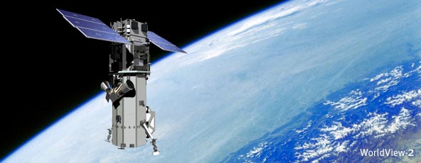
During the session, Dr. Navulur will discuss how the new spectral bands on the WorldView-2 satellite, set to launch October 6th, will provide improved value for remote sensing applications. As the first high resolution 8-band multispectral commercial satellite, WorldView-2 will produce better feature identification and classification, improved bathymetry and better change detection. Participants will learn:
§ How the four additional spectral bands (coastal blue, yellow edge, red edge, and near infrared 2) enable broader ranges of classifications, enhanced vegetation and coastal analysis, the extraction of more features and the identification and tracking of coastal changes and infractions.
§ How the new red edge (the first in the commercial industry) and yellow edge spectral bands deliver more granular field classifications, improve the understanding of vegetation analysis and provide early warning capabilities to industries that interact with, and depend on, the environment.
§ How the new coastal blue spectral band will enhance bathymetry studies for sea floors, coastal plains and waterways, discriminate features of the shallow ocean floor more accurately and increase the scope of coastal remote sensing applications--improving the safety of marine navigation and providing much needed insight into the ever changing marine environment.
§ How the WorldView-2 based portals and navigation devices will see the world in the truest natural state--bringing better definition and clarity to the user's visual reality, and allow mapping experts to use those bands to pinpoint more points of interest and create more diverse, interesting navigation applications.
What: Deeper Analysis, Faster Insight: Enhanced Applications with WorldView-2’s New Spectral Bands
When: Wednesday, July 29, 2009; 11:00am and 7:00pm (MDT)
To Register: Click here
Dr. Navulur has more than 18 years experience in remote sensing and GIS. He received his Ph.D in engineering from Purdue University and a Masters in Remote Sensing Applications from IIT in Bombay. He is currently an adjunct professor at the University of Denver.
About DigitalGlobe
Longmont, Colorado-based DigitalGlobe (http://www.digitalglobe.com) is a leading global provider of commercial high-resolution earth imagery products and services. Sourced from our own advanced satellite constellation, our imagery solutions support a wide variety of uses within defense and intelligence, civil agencies, mapping and analysis, environmental monitoring, oil and gas exploration, infrastructure management as well as internet portals and navigation technology.
With our collection sources, comprehensive ImageLibrary (containing more than 730 million square kilometers of earth imagery and imagery products) we offer a range of on- and off-line products and services designed to enable customers to easily access and integrate our imagery into their business operations and applications.
DigitalGlobe is a registered trademark of DigitalGlobe.
Forward-Looking Statements
This release may contain forward-looking statements. Forward-looking statements relate to future events or our future financial performance. We generally identify forward-looking statements by terminology such as “may,” “will,” “should,” “expects,” “plans,” “anticipates,” “could,” “intends,” “target,” “projects,” “contemplates,” “believes,” “estimates,” “predicts,” “potential” or “continue” or the negative of these terms or other similar words, although not all forward-looking statements contain these words. These statements are only predictions.
Any forward-looking statements contained in this release are based upon our historical performance and on our current plans, estimates and expectations. The inclusion of this forward-looking information should not be regarded as a representation that the future plans, estimates or expectations contemplated by us will be achieved. Such forward-looking statements are subject to various risks and uncertainties and assumptions relating to our operations, financial results, financial condition, business, prospects, growth strategy and liquidity. If one or more of these or other risks or uncertainties materialize, or if our underlying assumptions prove to be incorrect, our actual results may vary materially from those indicated in these statements.
These factors should not be construed as exhaustive and should be read in conjunction with the other cautionary statements that are included in documents filed by us with the Securities and Exchange Commission. The forward-looking statements made in this release relate only to events as of the date on which the statements are made. We undertake no obligation to update any forward-looking statement to reflect events or circumstances after the date on which the statement is made or to reflect the occurrence of unanticipated events.
